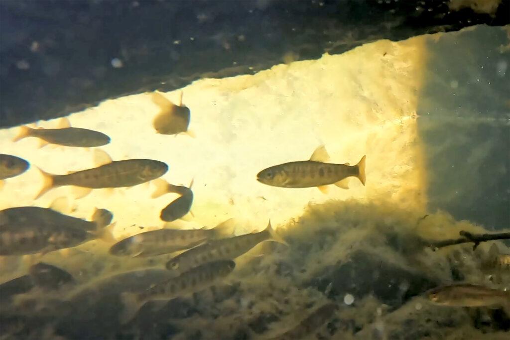
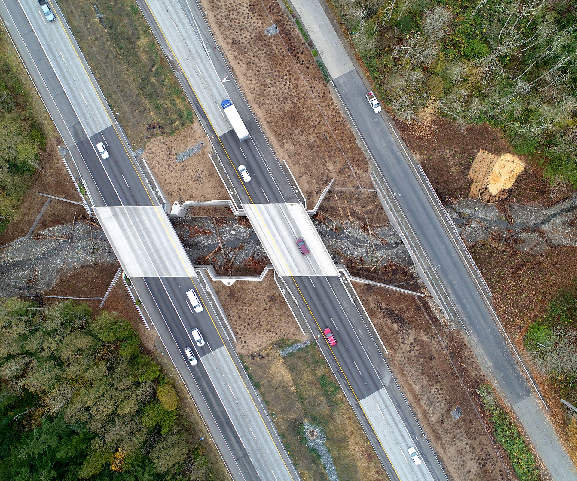
One thousand feet of new stream channel. One hundred and eighteen habitat features. Two fish-friendly culverts. Two bridges. The Padden Creek Fish Passage Design-Build was a big project with a big goal: to restore fish passage under SR 11 and I-5, connecting fish to five miles of upstream rearing and spawning habitat while minimizing disruptions to the traveling public through the process.
Was it successful? The final photo below speaks for itself.
Accomplishing this audacious goal required specialists spanning many disciplines, including KPFF civil engineers, structural engineers, and stream designers. Professionals from our Seattle, Lacey, and Special Projects offices teamed up, bringing unique and important perspectives that contributed to a successful final project.
Civil Engineer: The existing Padden Creek crossing at SR 11 consisted of two 78-foot-long, 5-foot by 3-foot concrete box culverts that had been designated as a fish barrier due to the steep slope. The location, next to a busy intersection, residential and business properties, and overhead power and communication utilities, created complex traffic management and construction challenges.
The original project design called for long-duration lane traffic phasing during construction which would have had a significant impact on the surrounding community and businesses. After the contract was awarded, the team approached WSDOT with an ambitious idea to reduce long term traffic impacts. If the team could install the entire 20-foot by 8-foot culvert during a full 60-hour weekend closure of SR 11, there would be no need for any other nightly closures. Through communication with the city and WSDOT, the team gained approval for a full weekend closure, associated detour plan, and city noise variance permit. The Granite Construction team closed SR 11 at 10:00 pm Friday and completed the entire box culvert by 2:00 am Monday—just 52 hours later.
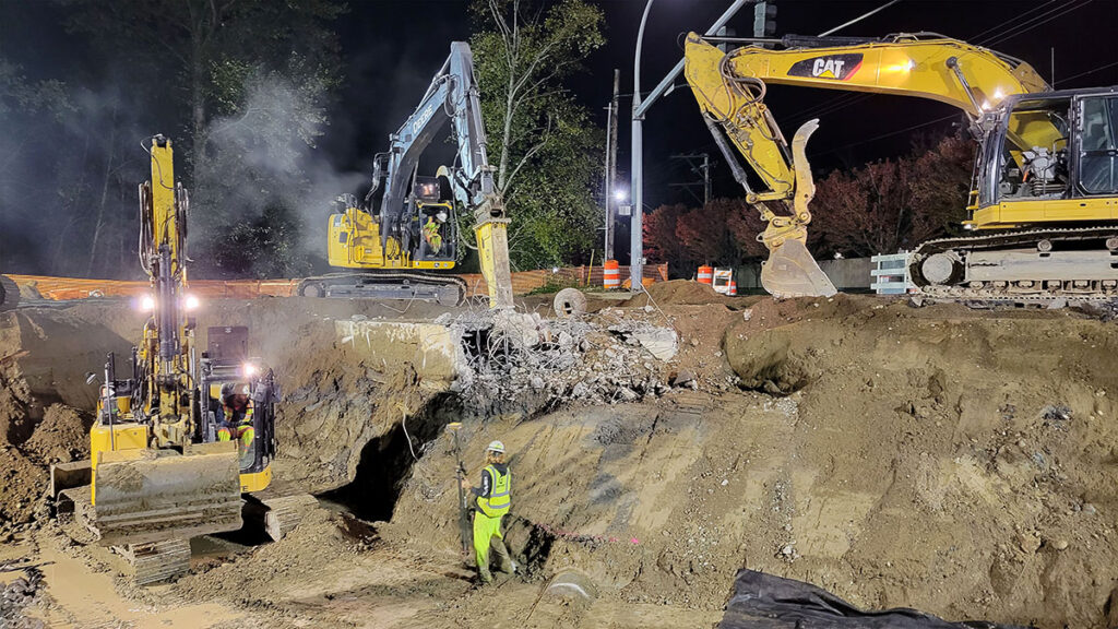
Structural Engineer: The I-5 site provided some unique challenges for the structural designers: the existing culvert was buried nearly 50-feet below one of the most well-traveled freeways in the state. Constructing two new bridges while minimizing traffic disruptions to this critical north-south corridor required an innovative solution. KPFF, Granite and GeoEngineers developed a mechanically stabilized earth (MSE) bridge abutment that was supported by a soldier pile cut wall. This unique design allowed Granite to construct nearly all of the project using a top-down methodology instead of more traditional bottom-up sequencing. In a top-down approach, permanent internal structures are built as excavation progresses down, providing lateral support for the retaining walls along the way. Thanks to this clever strategy, contractors could wait to excavate the bulk of the new stream channel (more than 30,000 cubic yards of material) until after the new bridges were already built and traffic was in its permanent alignment.
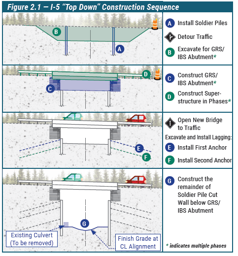
The top-down method and other design efficiencies decreased the total number of traffic impact days on I-5 from 400 to just 225 days, a reduction of nearly 50 percent. The Southbound I-5 bridge was constructed and opened to traffic just 38 days after work began. This was the first top-down bridge constructed on an Interstate within Washington. Traffic impacts were minimized so effectively that other firms are replicating the top-down methodology for at least six additional sites across Washington.
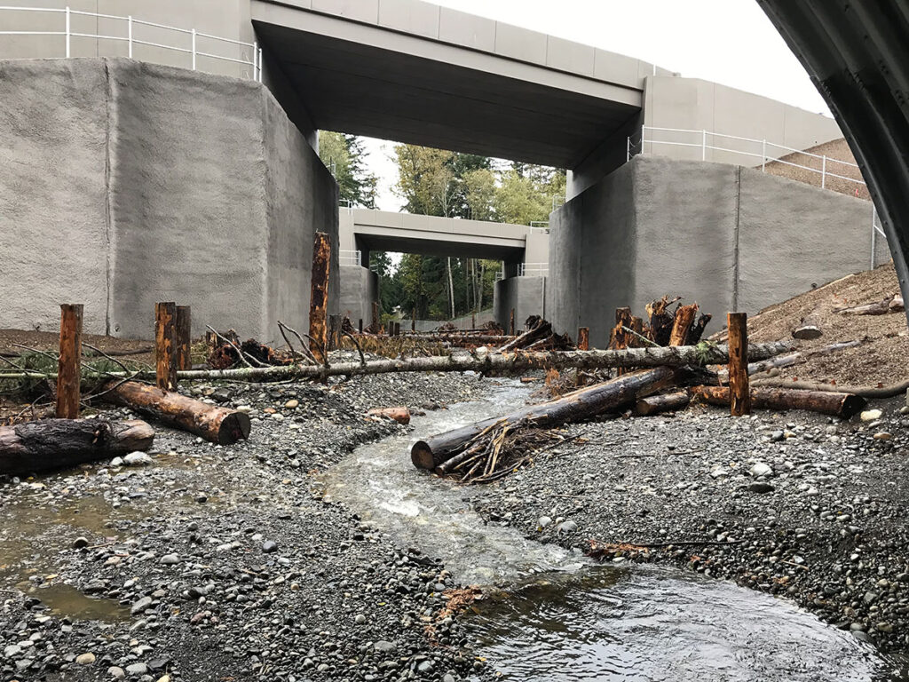
Stream Designer: In addition to removing fish barriers at I-5 and SR 11, the project team found ways to add habitat-enhancing features that will evolve with the stream system over time. At the SR 11 crossing, the team shifted the stream alignment from the conceptual design location so they could turn the area downstream of the crossing into a backwatered, off-channel habitat that floods at higher flows and provides a natural refuge for fish during storm events.
Large woody material (LWM) like fallen trees and root wads are critical components of healthy stream environments. They create low-velocity scour pools, offer shade and shelter to young fish, protect stream banks from erosion, and generally promote a naturally evolving and sustainable stream system. Understanding this, the Padden Creek team developed a color-coded and numbered LWM plan exhibit and LWM matrix to maximize habitat enhancement.
The matrix identified the size, orientation, location, and specific habitat function of each piece of LWM. This detailed approach allowed all parties to work together to optimize a stream design that mimics the natural environment. While this was not a contract requirement, everyone agreed that it was extremely beneficial to ensure each piece of LWM was placed with a specific habitat goal in mind. In total, 118 pieces of LWM were installed according to these designs, significantly exceeding contract requirements and enriching habitat and channel diversity across more than 1,000 linear feet of Padden Creek. Other improvements included side channels and pools, as well as channel spanning logs.
Streambed gravel is another critical component of fish spawning habitat, and the stream and environmental teams used an innovative approach to get this feature right for Padden Creek. The KPFF and GeoEngineers team collected six McNeil sediment samples to supplement more traditional Wolman pebble counts—a first for design-build stream crossing projects.
McNeil samples gave the team a much better understanding of the natural streambed material in Padden Creek by collecting material from as deep as nine inches below grade. The team combined McNeil and Wolman sampling data to better size proposed streambed material, resulting in smaller spawning gravel that mimics the natural environment and will provide high-quality habitat for all life stages of fish development. Areas of spawning sized gravels were designed and installed in places that will naturally remain spawning areas for salmon over time. WSDOT has since disseminated this unique methodology to all staff and consultants working on its injunction culvert correction designs.
When It Rains, It Pours
Shortly after the completion of the SR 11 crossing, Bellingham saw historic rainfall and stream flows exceeding the designed 100-year water elevations. Immediately following the record rainfall event, KPFF, Granite, and GeoEngineers met WSDOT on site to evaluate the status of the reach.
Although the storm displaced some gravel as expected, the LWM remained in place and functioned as intended—creating scour pools and microhabitat for future generations of fish. With a 20-foot internal span, the new box culvert handled the water volume much better than the smaller double-barreled culvert the team replaced. If the project hadn’t been completed before the storm, local flooding could have impacted SR 11 and the surrounding properties.
During the field visit, the team observed multiple species of salmon and steelhead trout, swimming, staging, and spawning both upstream of the newly installed culvert and downstream in the constructed spawning habitat. Not only did the design survive flows in excess of a 100-year storm, but the new reach is already sheltering several salmonid species, a strong indicator of the project’s successful long-term habitat enhancement.
